Is it Worth Buying a JR Pass?

JR PassFor anyone travelling to Japan with the intention of seeing more than one city, buying a Rail Pass of some sort is an important consideration to make. While there are a lot of train companies in Japan (with a lot of different rail passes), the one most people are likely familiar with is the JR Pass from the Japan Railways Group.

When buying a JR Pass, you have to decide if you want an ordinary pass, or a “First Class” pass which gives you access to nicer train cars. I find regular cars on JR Trains comfortable enough, so the only real consideration is the duration of the pass.

  • 7-Day: ¥29,110
  • 14-Day: ¥46,390
  • 21-Day: ¥59,350

So is it worth it to buy a JR Pass, or would you be better off just buying train tickets as you go? You’ll need to do a bit of research before you make a decision on whether to buy a pass or not. Here are my suggestions to help you make your decision.

  • Map out the “big segments” of your trip that you know you will be making (e.g. Tokyo to Osaka, Osaka to Kyoto, Kyoto to Tokyo, etc). Don’t worry about all the shorter segments you might use the JR Pass for.
  • Price out those segments using JR websites (or Google Maps does a pretty good job of showing fares when you use it for transit directions).
  • Look at your dates to determine what duration Rail Pass you would need.

After making that comparison, if the JR Pass is cheaper than buying the tickets individually, then I say go for it. Not only are you saving money on the cost of buying tickets individually, but you get other added benefits of having the JR Pass.

You might be open to going to different places (accessible via your pass) rather than just staying in your intended cities. Having the pass gives you options to see things you might not of wanted to spend money to see, but knowing it requires no additional cost, makes you open to checking it out.

You can use your pass within cities you are visiting, since JR runs intracity rail systems in some of the bigger cities (e.g. Osaka and Tokyo). I wouldn’t bother trying to price out these intracity trips when determining whether the JR Pass is worth it or not, but it’s nice to know you’ll be able to get some more value out of the pass.

So, how did the JR Pass work out for me and Kait? We bought a 14-Day Ordinary JR Pass which cost $558 CAD each. I’ll do the price comparison with the JPY cost of the JR Pass (46,390JPY) since that’s what the individual train tickets would have been purchased with, and depending on what country you buy your JR Pass from, you’ll be paying approximately the JPY cost plus a small currency exchange premium (dependent on who you buy the JR Pass from).

Here is a list of all the train (and boat) rides we took using our JR Pass:

  • Hakata to Beppu: ¥5560
  • Beppu to Hakata: ¥5560
  • Hakata to Hiroshima: ¥8940
  • Hiroshima to Miyajimaguchi: ¥410
  • Myajimaguchi to Miyajima: ¥180
  • Miyajima to Miyajimaguchi: ¥180
  • Miyajimaguchi to Hiroshima: ¥410
  • Hiroshima to Shin-Osaka: ¥10230
  • Osaka to Kyoto: ¥560
  • Kyoto to Saga-Arashiyama: ¥240
  • Saga-Arashiyama to Kyoto: ¥240
  • Kyoto to Inari: ¥140
  • Kyoto to Osaka: ¥1210
  • Tennoji to Nara: ¥470
  • Nara to Tennoji: ¥470
  • Osaka to Sannomiya: ¥410
  • Sannomiya to Osaka: ¥410
  • Osaka to Namba (Via Imamiya): ¥190
  • Shin-Osaka to Tokyo: ¥14140
  • Tokyo to Shinjuku: ¥200
  • Shinjuku to Akihabara: ¥170
  • Akihabara to Tokyo: ¥140
  • Shimbashi to Shinjuku: ¥200
  • Shinjuku to Shibuya: ¥160
  • Shibuya to Ebisu: ¥140
  • Ebisu to Shinjuku: ¥160
  • Shinjuku to Maihama: ¥390
  • Maihama to Shinjuku: ¥390
  • Shinjuku to Ueno: ¥200
  • Ueno to Shinagawa: ¥200
  • Shinagawa to Shinjuku: ¥170

Total: ¥52,470

Overall, I’m satisfied with the value we got out of our JR Pass. When we made rough plans for the trains we’d take in Japan, we included several longer distance day trips out of big cities that we ended up not going on, but we still came out ahead ¥6080 per person. That’s why I suggest only including the main segments of your trip when deciding on the JR Pass. Plans can change and you don’t want to feel like you have to go out of your way to use your JR Pass in order to make sure it was better value than buying individual train tickets.

If you’re the kind of person looking to maximize value, and are willing to plan your trip around maximizing the value of your JR Pass, then I think you can come out way ahead of the cost of buying individual train tickets.

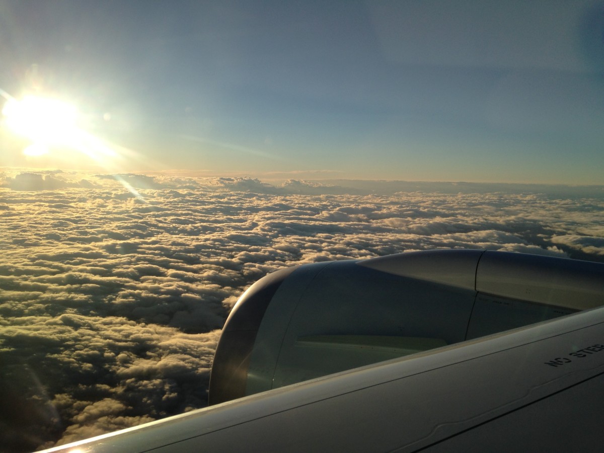
While rail passes can offer good value, train travel in general in Japan is not exactly cheap (e.g. Tokyo to Osaka round trip on the Shinkansen is $320 CAD). Depending on your itinerary, it might actually be cheaper to fly between cities than to take the train. Kait has mentioned before the discount airline tickets you can buy as a foreign visitor in Japan, and that might be a better option for you if a Rail Pass isn’t a good fit.

With the lack of great train travel options in North America, I get this romantic notion about trains whenever I travel to places with good train systems. In that sense, there are some intangible values to getting a train pass that I can’t put a dollar amount to. Overall, Kait and I were both really happy with our JR Pass experience, riding trains for over 2000km around Kyushu and Honshu.

(I await the day we have high speed rail down the west coast from Vancouver to San Diego)

Tracking Steps: Google Fit vs Moves

If you’ve been keeping up with Kaitlyn’s Travel Log, you’ll know that she’s been reporting our step count each day. Before we started our trip, I wanted to keep track of our steps throughout our travels. I liked some of the ideas of the Quantified self and figured our step count would be an interesting thing to measure. (I also thought it could be a good angle for our travel blog). Over Christmas and Boxing Day, I kept my eye out for good deals on fitness trackers but I couldn’t find any good sales. I then turned my eye towards fitness tracking apps for my phone.

Here were my requirements (in order of priority):

  1. Not kill my battery life
  2. Track daily steps
  3. Provide export options
  4. Track our locations and display it on a map

After doing some research, I narrowed my list down to two apps:

  • Google Fit
  • Moves

Google Fit

Google Fit is Google’s “Fitness Platform” for Android, with the idea that it provides a single place for you to track all your fitness needs. It can be paired up with activity tracking devices (like FitBits), but more importantly for me, it can make use of your phone to perform the activity tracking. Being a Google made app, it makes use of the activity tracking co-processors that are found in some phones now, which should help preserve battery life.

Main screen shows your activity for the day... 0 steps, because my phone has been idle all morning as I worked on this post.
Main screen shows your activity for the day… 0 steps, because my phone has been idle all morning as I worked on this post.
Scroll down and you see the total steps by day (or by week or month). Select a day and it breaks down the activities by session.
Clicking into one of the active sessions shows info about that session, along with a map of the route.

Moves

I tried the Moves App when it first came out on my old Nexus S. It provided activity tracking and also mapped out the locations of those activities. I thought of it like an automated spatial journal. It made it easy for me to look back and remember where I was at any given time. The big problem for me back then though, was that it killed my battery life. I couldn’t get through a day without my phone needing a charge, so I had to uninstall it.

Fast forward to today, and now the Moves app is owned by Facebook. It also makes use of motion co-processors in phones, so it shouldn’t kill the battery. The only other big change I see in the app now is that it has also developed itself into a platform of sorts, and there are numerous companion apps that can make use of the data that Moves is tracking.

Main screen shows your activity for the day, along with a timeline of sorts. Swiping left or right changes the day.
The timeline shows places you went, along with the way you moved from point A to point B.
Selecting a place or a segment of transit opens a map showing the route of the activity or the location of the place you were at. You can trace your steps in the map view going from place to place.

Google Fit vs Moves

Okay, so the main point of this article isn’t to review the apps, but to see how well they’ve been tracking our steps. I wanted to see if their step counts were comparable (i.e. “do the two methods of measurement agree sufficiently closely?”, Altman and Bland) and how best we should be logging and reporting our steps. (So far, we’ve been reporting the average between the two step counts, rounded to the nearest 100 or so).

We’re about 50 days into our trip, and other than a couple days where one app or the other failed (i.e. the background process running on the phone crashed and didn’t restart), both apps have been running smoothly. We have 46 days worth of step counts where both apps were running, and that’s the data I’ll be using.

First, I did a scatter plot with one point for each day. Google Fit on the x-axis and Moves on the y-axis. If their step counts are close, I should expect the points to follow a 45 degree line closely (i.e. x and y values should be very close in value).

Fit vs Moves

So far so good. For the most part, it seems like both apps are doing a reasonable job matching each other step for step, including higher step count days. In order to check this more clearly, I created a second plot. This plot compares the difference in step count vs the average step count for each day. If both apps measure step counts very closely, all the points should fall close to the x-axis. If the difference in step count grows as the total step count increases, then I would expect the plot to deviate from the x-axis as we go further to the right in the plot. Either way, what I’m hoping to see here is no clear pattern with how the difference between the two step counts deviate, regardless of how many steps were taken that day.

Difference vs Average

Okay, so the difference that we’re looking at here is the Google Fit count subtracted by the Moves count. While things are clustered around the x-axis (i.e. zero difference), it’s a bit more spread out than I would have hoped. The good thing here though, is that there doesn’t appear to be any clear pattern of the difference increasing with the higher step count days. (In fact, the highest couple step count days show very close counts).

Visually inspecting those two graphs, I’m fairly confident the two apps are measuring our step counts in a similar way, and one isn’t way off from the other. With that in mind, what’s the best way for us to report our step counts? We could probably just use one app (and save some battery on my phone), but since I have nothing to determine the accuracy of the step counts, and only know the two are relatively precise, I think my best bet is to continue reporting the average between the two (similar to some of the ideas from “The Wisdom of Crowds” by James Surowiecki, though I guess there is a certain expectation of accuracy for the two counts for this to really help).

With that in mind, I also looked at the standard deviation of the difference in step count… 1185 steps (or about 5% of our average steps per day). Based on that, we’ll continue to use our average step count when reporting our daily steps, but I think we’ll start rounding to the nearest thousand.


Step Summary

If by chance you’ve gotten this far in my post, here’s some extra step related notes on our trip so far (as of April 18).

Total steps: 983,000
What!? We’ll probably hit a million steps today or tomorrow. Not sure how many days it’d take me to walk a million steps back in Vancouver, but I’m pretty sure it’d take more than 50 days. It was pretty exciting for me to see this number, as I have a lot of respect for how big a number one million is.

Average steps per day: 20,000
I’m quite happy about this. We set 20,000 steps per day as our goal, and while we haven’t hit it every day, the fact that our average steps per day is right on target is pretty awesome. It means our higher step days are nicely balancing our lazier days.

Most steps in a day: 44,548
This came pretty early on our trip on Day 4, when we got up early to hike Elephant Mountain in Taipei.

Fewest steps in a day: 10,027
Similar to our average steps per day, I’m quite happy about our fewest steps in a day. 10,000 steps per day (rightly or wrongly) is often given as the recommended number of daily steps for healthy living, so knowing that even our most inactive days reaches this threshold is a good indicator that we’re living a more active lifestyle now than we were before.

I was tempted to hold off on posting this since we’re so close to a million steps, but I figure I may a well post it, and Kaitlyn can say something about reaching a million steps when we actually hit it.

Watching TV While Travelling

Back in 2006 when I spent 3 months in Europe with my sister, I watched and kept up with a lot more TV shows than I do now… How I Met Your Mother, The Sopranos, 24, Lost, Veronica Mars (*sigh*), One Tree Hill, Scrubs, etc. (You can tell a lot about a person based on the shows they watch…). But since my trip was from June to September, missing episodes wasn’t really a concern. This time around, we’re travelling right in the middle of the TV season, so even though it’s a total luxury, I made it a point to make sure we can keep up with whatever TV shows we want to watch.

Prior to this trip, I was already a somewhat frequent traveller for work, and I’d always bring my Nexus 7 (2013) with me to watch TV shows, movies, and read books. The tablet has 32GB of storage, and I’d copy media to it for each trip. For this trip with Kait, our requirements are slightly different. We’re travelling for way too long for a 32GB device to fit enough media to last the whole trip, and we won’t only be using the device to consume media when we’re on planes and trains. We’ll want to be able to watch things together wherever we’re staying, and it’s a lot easier to do that on a TV than on a 7-inch tablet.

So, there are 2 functions we required in order to satisfy our need for TV from back home.

  1. Get/Download the latest TV Shows after they air.
  2. Play the downloaded shows on TVs wherever we’re staying.

Now, we have a Netflix membership which is good for some content, but other than Netflix produced television shows, the only other show that gets new episodes weekly on Netflix (in Taiwan at least) is Better Call Saul. That leaves “less mainstream” ways for us to get everything else we want to watch… but that’s never been much of an issue for me.

That leaves #2, getting the shows we want to watch on to the TVs where we’re staying. Or, for those interested in the more technical specifics, I want to smoothly stream Scene Standard 720p x264 encoded videos from my tablet (Nexus 7, 2013), phone (Nexus 5x) or laptop (Macbook Pro, 2009) wirelessly to a TV.

IMG_20160407_213036
The goal is to get that video (Masterchef Canada) playing on a TV through the Chromecast

Our current (imperfect) solution uses a Chromecast to stream the videos from our devices to a TV. The Chromecast works with our phones (Android and iOS), tablet (Android) and Laptops (Chrome Browser). On top of the local content, it also lets us stream videos from services like YouTube and Netflix.

In order to stream local (downloaded) content from our devices, I needed to find an Android App that could “cast” the videos to the Chromecast. After some testing, the best (free) app I could find is called ES Chromecast Plugin. This plugin requires ES File Explorer (which is the file explorer I already prefer on Android), and it allows you to browse to whatever video file using ES File Explorer, and then cast it to a connected Chromecast device.

Another (free) option that works so-so is to Cast the entire device screen, then play the video using VLC. Interestingly, when you are casting the whole screen and start playing a video in VLC, it doesn’t actually play on the device and mirror to the Chromecat, but it plays exclusively to the Chromecast and the screen on your device shows playback controls. Overall, I find the ES Chromecast Plugin performs better.

For streaming from our laptops, if the video file can be played inside a Chrome tab, then you can just cast that tab. For everything else, I found an app called “Videostream for Google Chromecast” which works really well for streaming all sorts of video files (and it does the best job at streaming 720p videos).

Now, while this is a working solution, it isn’t ideal…

Your device and the Chromecast need to be on the same LAN in order for the devices to see each other. If you’re connecting to hotel WiFi (or some other public WiFi), the connected devices probably won’t have permission to see other devices on the network. Second, if the WiFi you’re connecting to has a captive portal (e.g. click here, view this ad, agree to the terms of service, etc), then the Chromecast device can’t get past the portal to connect to the internet.

The solution to this is to create your own LAN/WiFi for the Chromecast and your devices to connect to, so they are on the same network. I bought a travel router for just this purpose (I’ll write about it later).

Another problem, (or “feature”), of the Chromecast is that it MUST have internet connectivity in order to work… even if you’re only playing local content (i.e. not streaming video from the internet). I found this out the hard way, and it was pretty disappointing since it really doesn’t make any sense. The only logical explanation I can think of is that the Chromecast sends usage data back to Google, and even when you are playing local content, Google wants to know what you’re doing… They want to know so bad that they won’t let the Chromecast work even if everything your casting to it is local.

For the most part, this hasn’t been an issue for us, but it’s enough of an issue that makes it really hard to recommend our current solution (Or the Chromecast in general) to others. For example, say I have a TV, a Chromecast, and a photo on my (Android) phone… why on earth should I need Internet access to put that photo onto the screen through the Chromecast when both the Chromecast and my Phone are connected to the same network. Perhaps I expect too much from a < $50 device, but when it feels like it’s being artificially crippled, it’s frustrating.

The last issue (and the reason I’ll continue to look for a better solution) is that 720p videos don’t stream perfectly from my tablet to the Chromecast. The videos play fine on the tablet itself, and I’ve seen 720p-like video play from the Chromecast just fine when it’s streaming from Netflix, so I suspect the issue is either in the app I’m using to cast the video (ES Chromecast plugin was the best, but I tested others that performed worse, so software can definitely improve casting performance), or in the network throughput I’m getting with my travel router (more testing needed). The videos play fine for the most part, but the occasional stutter is really annoying.

So, this is what our current setup looks like:
– Google Chromecast (the newer one)
– HooToo TripMate TM06 Elite Travel Router
– Nexus 7 (2013)
– SD x264 TV Releases (1hr TV Shows come in at 200-300MB or so), since 720p videos stutter
– ES Chromecast Plugin (For ES File Explorer, Android)
– Videostream for Google Chromecast (For Video Files on PCs that won’t play in Chrome)
– Whatever TV (with HDMI Input) we have access to.

Thanks to this setup, Kaitlyn had the pleasure of enjoying nearly 3 hrs of The Bachelor Finale…

Changing Input Source on Chinese (Mandarin) TVs

So, say you’re travelling in Taiwan, and you’ve got yourself a Roku Stick, (Chromecast, Fire TV, Miracast Dongle, etc), and you’ve finally (blindly) plugged it into the back of the wall mounted flatscreen TV in your hotel room, and now you just want to change the input source for the TV so you can start watching things from the device you just (struggled) to plug in, but you’re faced with controls on the TV and Remote Control that are all in Mandarin, and don’t have the familiar arrow-pointing-into-a-curved-rectangle icon that you’re used to. Well, you could do what I did and hit every single button until you find the one that changes the input source (and in the mean time, accidentally change a bunch of other settings on the TV), or you can read on below to see what button to press.

Look for a button labeled with these characters on the TV or Remote

輸入選擇
Pronounciation: shūrù xuǎnzé
Translation: input select

Sometimes it’s just 輸入 which means “input”. Rotate through the HDMI inputs until whatever you’ve plugged into the TV shows up, and enjoy!

Taxis vs Transit vs Walking

To travel is to move from one place to another, and when faced with getting from point A to point B, Kait and I do what most people do these days… we use Google Maps.

People move around in different ways, and when it comes to travelling, how you move around can really define what type of traveller you are, and what your “style” of travel is. When travelling long distances from one city to another (or one continent to another), you can go by plane, boat, train, or automobile (or Hyperloop in a decade?). What I’m talking about now though is at a smaller scale. How do you get around once you’re at your “destination”? What’s your preferred mode of travel?

  • Private tours with drivers
  • Tour groups on highway coaches
  • Renting or driving your own car around
  • Taxis/Uber
  • Public Transit
  • Hitch-hiking
  • Cycling
  • Walking

Chances are you use some combination of the above, but what your preferences are and the distribution of your usage define your travel style.

So far on this trip (and in general when we travel), our choices are really defined by the directions provided by Google Maps: Drive, Transit, (Cycle) or Walk.

Driving
Without a car, driving for us basically means taking a taxi. Driving almost always provides the fastest option, but it’s also the most costly. When we travel, we usually take it easy and try not to make ourselves feel rushed. So driving is usually the first option to get eliminated.

Taking Pubic Transit
Most transit options that Google Maps covers are either buses or rapid transit (e.g. Subways, Metros, etc). For me, they couldn’t be more different. I love rapid transit but despise buses. Either way, transit is more cost effective than driving, and is our top choice when we need to travel longer distances. I love seeing and using the rapid transit systems around the world. It’s one of my favourite things about a city. They’re a great way to see (creep on) locals out and about, they don’t make me car sick like (stupid) buses, and they’re efficient at moving lots of people in densely populated areas. If it takes us longer than a hour to walk (yes, an hour… even if it’s uphill to the mid-levels in HK with luggage), then we’ll probably take transit.

Walking
My favourite mode of travelling around town is walking. You get a real feel for a city when you’re walking. You see the streets, you see the people, you experience the climate (good or bad), and you have every opportunity to stop and smell the roses. When you walk, you can go off the beaten path. When you walk, you get to experience the wonders of bipedal gait. You never stumble across a great discovery when you take a cab, and the areas surrounding transit hubs rarely offer any treasures, but when you walk, you open yourself up to the unexpected and to unique discoveries. Most of my favourite memories (and meals) when travelling have been because I walked. Although a personal choice, I highly recommend walking as much as you can when you travel.


Fitbit (the authority on this apparently when I did a Google search) recommends 10,000 steps a day. That’s a pretty difficult goal if you drive to work at a 9-5 and don’t do anything active in the evenings. That’s not a very difficult benchmark to reach if your travelling and your primary mode of transportation is walking. With that in mind, Kait and I set a goal of trying to reach 20,000 steps a day. She’s been including our step counts in her daily posts, and we’ll look at sharing more (like distances and maps) in the future.

Mapping our Trip

The last time I travelled for an extended period of time (2+ months), it was 2006 and I did the whole backpacking through Europe thing with my sister. On that trip, I shocked myself that I had the discipline to write every day in a journal. Even on a night where I barely remember how I got back to the hostel (in Lagos), low and behold, there was some (not so great quality) writing logging the events of the day. This time around (and this is probably the first of many comparisons I will make to 2006), I find myself lacking in discipline to write about the events of this trip on a daily basis. I’m so glad Kait is motivated and putting together an excellent record of our trip that we can look back on in the future.

Do you ever have a deep desire to do something, and are really motivated (or downright OCD) to do some very related things, but just can’t bring yourself to do the actual thing? That’s me with daily journalling. There are a lot of good reasons to journal, and I was recently inspired again to keep a daily journal by something my cousin wrote, but although I’m disciplined in a lot of aspects of logging my daily life, writing out the day’s events in prose is not one of them. I recognize that short coming, but still want to keep a log of things we’ve done, and record my thoughts, on a regular basis. Our memories are incredibly flawed (in the sense that we really don’t remember things the way we think we do), so it’s valuable to keep a record of events and of our thoughts and emotions as they happen, in order to more accurately reflect on the past.

With that in mind, I already do two things rather compulsively that keep a pretty good log of my daily events: I track every penny I spend and I record events in Google Calendar. I started doing both these things for different reasons, but I’ve found that they’ve had the added benefit of providing a pretty good log of my day to day activities. For this trip, I’m adding a third item to this list that, while serving another purpose, will also provide a good log of our activities.

I will be mapping out our trip as we go, and sharing it here on the blog. The main purpose of the map is to share the places we’ve been to and talked about in blog entries, and hopefully make it easier for people to find them if they decide they want to go to the same places. While Google Maps is pretty incredible in North America, I find that a lot of locations we are going to are not actually on Google Maps, so finding them may not be so easy. With the map that we’re creating, we’ll drop pins on the locations of places even if they’re not on Google Maps. Hopefully someone will find this useful!

The map also creates a spatial log of our trip (along with the spending log) which helps provide a record for us to look back on. For me, this helps lift the burden of writing a daily journal logging the events of the day. However, this doesn’t mean I don’t want to write. It lets me focus my journal on thoughts and feelings without the “chore” of listing out daily events. I can still write about events of the day, but I’ll know I’m not obligated to because they’re being recorded elsewhere in a different fashion. (And worst case, I’ll always have Kaitlyn’s blog entries… but of course those will record the events as seen through her experience, not mine).

So my “Journal” for this trip looks something like this:

Hopefully they’ll provide a satisfying record of our adventures and provide insight to future Tim regarding current Tim.

Making the Most of Aeroplan Points

The “backbone” of our current leg of travel is an Aeroplan Rewards booking. This booking is a round trip flight from Vancouver to Melbourne, Australia, with layovers in Taipei on the way there, and in Ho Chi Minh City on the way back. This cost us 80,000 points each plus $596.21 in additional fees. Aeroplan changed their redemption costs last December, so North America to Australia is now 90,000 points. Now, the additional fees weren’t ideal, but they were by far on the lower end of things when we looked at different itinerary options, and more importantly, if we wanted to reduce the surcharges further, we would end up with less than ideal flight options.

Before I get into too much detail, let me first say that in my experience, talk of travel and rewards bookings online are either too complicated and advanced (and only understood by people who spend all their time on FlyerTalk Forums) or too simple without concrete examples and advice. Hopefully I strike a balance between the two, so you can understand what Kait and I did without knowing ICN > HND is going from Seoul to Tokyo.

There are just 2 things you need to do to maximize the value of your Aeroplan Points when making a redemption:

  1. Book a round trip fixed-mileage flight reward with 2 layovers
  2. Choose flight segments on airlines that don’t have surchages

1. Layovers

One of the best things about Aeroplan flight rewards is that you get to have 2 layovers (i.e. Stops in cities for longer than 24 hrs) added to your itinerary for free (or for the cost of the additional surcharges on the extra flight segments, see #2). So, in our case, booking a round trip reward flight from Vancouver to Melbourne costs the same amount of points as booking reward flights from Vancouver to Taipei to Melbourne to Ho Chi Minh City to Vancouver. So always add 2 layovers to a reward booking to maximize value.

(There are rules about total distance you can fly, and thus, what cities are viable layovers. This gets into the advanced stuff. Try to pick your destination city for the round trip to be as far from your starting city as possible for a given rewards booking, and most reasonable layovers on the way there and back should work).

2. Minimize Additional Fees

Air Canada is part of the Star Alliance, so Aeroplan points can be used for reward bookings on flights with any carrier in the Star Alliance. Each airline and their respective rewards programs differ from one another, and each have their own policies with regards to additional surcharges for reward bookings. In the case of Aeroplan rewards bookings, if the carrier airline charges additional fees for reward bookings, Aeroplan passes those fees on to you. If the airline doesn’t charge additional fees, then Aeroplan does not charge you additional fees. So, the trick to minimizing additional fees is to plan your route in such a way that all (or most) of your flight segments are on Airlines that don’t charge additional fees for rewards bookings. Which airlines are those? Here’s the list:

  • Air China
  • Brussels
  • EgyptAir
  • Ethiopian
  • EVA Air
  • Scandinavian
  • Singapore
  • Swiss
  • Turkish
  • United

Value of Points

Conservatively, for our booking it would have cost around $2600 to book flights to all the cities in our itinerary. Taking away the $600 we paid in surcharges, our 80,000 points was redeemed at a value of approximately $2000. This gives a value of 2.5 cents per Aeroplan point.

General rule of thumb for Aeroplan points, anything better than 1.5 cents per point is good value. Don’t use your points if your getting less than that.


So that’s a quick overview of how to maximize the value of your Aeroplan Points. I’ll have another post in the future on how to actually plan out your itinerary trying to follow these 2 rules using the Aeroplan booking tool.